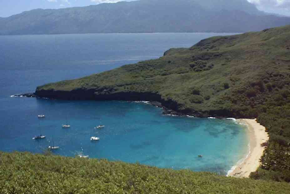
 A view of
the anchorage from the first ridge. Hiva Oa in background.
A view of
the anchorage from the first ridge. Hiva Oa in background.Stacy and I decided to do a little hiking today. It turned out to be quite an adventure. We set off about 10AM. First we walked along the beach to the side of the ridge that runs along the south side of the bay. From a distance the hill looks to be covered with nice soft grass. Unfortunately it is actually waist to shoulder high and consisted of about 70% dead, dried brush with the remaining 30% of the same variety but living. It is very tangled and anyone foolish enough (like us) to try to climb through it wearing shorts would soon find their legs very scratched. Under the plant matter there are rocks and some loose dirt. It is about a 30 degree angle up and took us a good, solid, sweaty half hour to reach the ridge.
A view of
the anchorage from the first ridge. Hiva Oa in background.
We followed the ridge up and towards the center of the island and had some great views of the anchorage. Eventually we got into some trees. There was a good breeze and it was very comfortable in the shade. We had a little lunch and some water flavored with lime juice squeezed from limes we found at the beginning of the hike. At this point we had already drank 2 of our 3 bottles of water. This was a bad sign.
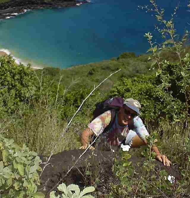 Climbing
some rocks. This was before we got too tired to take photos.
Climbing
some rocks. This was before we got too tired to take photos.
We continued up and to the east. At some points it was pretty steep on both sides making leaving the ridge a difficult proposition. Then we got into a section that was covered with downed trees. Several of these trees had fallen along the ridge making it impossible to avoid the tangle of upper branches. They were half covered with vegetation, and it was a real mess to get through. Our pace dropped to maybe 2 or 3 yards a minute and sometimes we did not touch the ground for 10 or 15 minutes at a time. A couple times we fell through the branches up to our armpits with out feet dangling in the mess below. At one point when it looked pretty hopeless I told Stacy that we would soon be out and would come upon a building with a Coke Cola sign. She said that we didn't have any money. I changed my prediction to include free Coke Cola.
After maybe 45 minutes or an hour we cleared the tangled mess of downed trees and found a small banana plantation and a little tent shelter. We followed a path from the tent and suddenly there was a road. Just 50 yards down the road we found a construction crew doing some work. Stacy talked to them for a few minutes and then asked if they had any water. They didn't, but they handed us a ............. can you guess...................2 liter bottle of Coke Cola. It was warm and only half full, but it was most refreshing. We thanked the workers and continued down the road.
Our plan was to follow the ridge we were on up until it joined the north-south ridge that divided the island. We would take that north until we met up with the ridge that ran back west along the north side of the anchorage. It was on this ridge that there was a very tall rocky peak overlooking the anchorage. We hoped to climb this peak and then head back down to the bay. Luckily the road continued in out general direction for quite a while.
Eventually we reached the north-south ridge. From here we could see a village on the east side of the island and the anchorage on the west side. We left the road and started up the ridge going west and towards the tall peak. We alternated between walking through the waist high brush that tore at out bare legs and areas with trees that was sometimes better and sometimes worse. Eventually we reached the base of the high peak and after about 20 minutes of climbing up over large boulders we reached the very top. What a beautiful view. We sipped a little water - at this point our last water bottle was only half full - and then headed back down. It was 3:20. We had been hiking for over 5 hours. Though we were pretty pooped, we needed to keep moving our we would not make it back before night fall.
We continued to follow the ridge west. It was good to be able to see the anchorage and our path ahead of us, but our legs were really sore and bleeding. Maybe it would be better below in the trees. We headed down into the valley. We were making OK progress, but it was a little disturbing to not be able to see where we were going. I knew that if we kept heading down and kept moving towards the setting sun, we would eventually end up at the anchorage. Stacy was not always so sure, and she really didn't want to sleep in the woods.
After a while we reached some steeper ground, and we had to climb down the rocks. We usually enjoy this kind of terrain, but at this point we just wanted to get back to the boat before dark. A little further down we hit a creek bed. There was no water, but big rocks and broken trees surrounded by dense vegetation. It was actually pretty easy, and we kept up a good pace. We continued down the creek bed for a long time, and it seemed like we should have already reached the shore, but it just kept going. Then I finally heard waves. We ended up coming out onto the beach only 20 feet from where we had left the dingy. It was about 5:30PM. The dingy was gone and a kayak was left in it's place (Guy was out catching dinner). Stacy took the kayak, and I swam back to Ladybug.
We were very tired and thirsty and glad to be home. We drank a lot of water, cleaned our wounds, drank a lot of water, ate, and drank a lot more water. We soon felt much better and were happy with our day's adventure. In retrospect, though, we should have been carrying much more water as we had gotten really dehydrated. By the time I went to bed I had drank 9 pints of water and had barely peed a drop.